OGC标准介绍 14
2010-07-16 23:33
316 查看
· Transaction操作
1. KVP格式请求 Transaction操作使用KVP格式请求目前只支持Delete(Insert和Update必须通过XML格式请求发送)。Transaction操作需要以下的参数:| 参数 | 是否必须 | 默认值 |
| VERSION | 是 | 1.1.0 |
| SERVICE | 是 | WFS |
| REQUEST=Transaction | 是 | |
| OPERATION=Delete | 是 | |
| TYPENAME | 是 | |
| RELEASEACTION | ||
| FILTER | ||
| BBOX | ||
| FEATUREID |
http://www.someserver.com/wfs? SERVICE=WFS&
VERSION=1.1.0&
REQUEST=Transaction&
OPERATION=Delete&
TYPENAME=InWaterA_1M,BuiltUpA_1M&
FILTER=(<Filter><Within><PropertyName>InWaterA_1M/wkbGeom<PropertyName>
<gml:Envelope>
<gml:lowerCorner>10 10</gml:lowerCorner>
<gml:upperCorner>20 20</gml:upperCorner></gml:Envelope></Within>
</Filter>)(< Filter><Within><PropertyName>BuiltUpA_1M/wkbGeom
<PropertyName><gml:Envelope><gml:lowerCorner>10 10</gml:lowerCorner>
<gml:upperCorner>20,20</gml:upperCorner>
</gml:Envelope></Within></Filter>)
2. XML格式请求 以下是一个WFS使用XML格式的Transaction操作示例:
<?xml version="1.0" ?>

<wfs:Transaction version="1.1.0" service="WFS"

handle="Transaction 01" xmlns="http://www.someserver.com/myns"

xmlns:wfs="http://www.opengis.net/wfs" xmlns:ogc="http://www.opengis.net/ogc"

xmlns:gml="http://www.opengis.net/gml" xmlns:xsi="http://www.w3.org/2001/XMLSchema-instance"

xsi:schemaLocation="http://www.someserver.com/myns
 http://www.someserver.com/wfs/cwwfs.cgi?
request=DESCRIBEFEATURETYPE&

typename=ELEVP_1M,RoadL_1M,BuiltUpA_1M
 http://www.opengis.net/wfs ../wfs/1.1.0/WFS.xsd">

<!--

Create a new instance of feature type RoadL_1M which has complex

properties segment and roadType.

-->

<wfs:Insert handle="ComplexInsert">

<RoadL_1M>

<name>Highway 401</name>

<segement>

<designation>SEG_A41</designation>

<geometry>

<gml:LineString gid="e3"

srsName="http://www.opengis.net/gml/srs/epsg.xml#63266405">

<gml:posList>...</gml:posList>

</gml:LineString>

</geometry>

</segment>

<roadType>

<surfaceType>Asphalt</surfaceType>

<nLanes>12</nLanes>

<grade>15</grade>

</roadType>

</RoadL_1M>

</wfs:Insert>

<!--

Update the designation of a particular range of segments which are now

being collapsed into a single segment. The The filter uses an XPath

expression to reference the designation property

-->

<wfs:Update typeName="RoadL_1M">

<wfs:Property>

<wfs:Name>RoadL_1M/segment/designation</wfs:Name>

<wfs:Value>SEG_A60</wfs:Value>

</wfs:Property>

<ogc:Filter>

<ogc:PropertyIsBetween>

<ogc:PropertyName>RoadL_1M/segment/designation</ogc:PropertyName>

<ogc:LowerBoundary>

<ogc:Literal>SEG_A60</ogc:Literal>

</ogc:LowerBoundary>

<ogc:UpperBoundary>

<ogc:Literal>SEG_A69</ogc:Literal>

</ogc:UpperBoundary>

</ogc:PropertyIsBetween>

</ogc:Filter>

</wfs:Update>

<!-- Delete the feature instance BuiltUpA_1M.1013. -->

<wfs:Delete typeName="BuiltUpA_1M">

<ogc:Filter>

<ogc:GmlObjectId gml:id="BuiltUpA_1M.1013" />

</ogc:Filter>

</wfs:Delete>

</wfs:Transaction>
3. 响应示例
以下是一个WFS的Transaction操作的响应示例:
<?xml version="1.0" ?>

<wfs:TransactionResponse version="1.1.0"

xmlns:wfs="http://www.opengis.net/wfs" xmlns:ogc="http://www.opengis.net/ogc"

xmlns:xsi="http://www.w3.org/2001/XMLSchema-instance"

xsi:schemaLocation="http://www.opengis.net/wfs ../wfs/1.1.0/WFS.xsd">

<wfs:TransactionSummary>

<wfs:totalInserted>1</wfs:totalInserted>

<wfs:totalUpdated>1</wfs:totalUpdated>

<wfs:totalDeleted>1</wfs:totalDeleted>

</wfs:TransactionSummary>

<wfs:InsertResults>

<wfs:Feature handle="ComplexInsert">

<ogc:FeatureId fid="RoadL_1M.1553" />

</wfs:Feature>

<wfs:Feature handle="Statement 2">

<ogc:FeatureId fid="RoadL_1M.509876" />

</wfs:Feature>

<wfs:Feature handle="Statement 2">

<ogc:FeatureId fid="BuiltUpA_1M.509877" />

</wfs:Feature>

</wfs:InsertResults>

</wfs:TransactionResponse>
· ArcGIS Server对WFS的支持
ArcGIS Server 10中支持的WFS版本为最新的1.1.0。在ArcGIS Server中,只需简单地勾选的Capabilities选项卡中可以选择支持WFS,如图 19。如果勾选了Transaction复选框,那么通过该WFS还可以进行数据更新(注意,需要是SDE数据源)。
图 19 ArcGIS Server发布WFS服务
现在我们在浏览器中执行一个GetFeature操作,查询名为“Beijing”的对象:
http://localhost:8399/arcgis/services/test/wfsTest/MapServer/WFSServer?
request=getfeature&
typename=test_wfsTest:sde_cities&
filter=(
<ogc:Filter>
<ogc:PropertyIsEqualTo>
<ogc:PropertyName>CITY_NAME</ogc:PropertyName>
<ogc:Literal>Beijing</ogc:Literal>
</ogc:PropertyIsEqualTo>
</ogc:Filter>
)
这个操作返回如下的结果:
<wfs:FeatureCollection

xsi:schemaLocation='http://localhost:8399/arcgis/services/test/wfsTest/MapServer/WFSServer http://localhost:8399/arcgis/services/test/wfsTest/MapServer/WFSServer?request=DescribeFeatureType%26version=1.1.0%26typename=sde_cities http://www.opengis.net/wfs http://schemas.opengis.net/wfs/1.1.0/wfs.xsd'
xmlns:test_wfsTest='http://localhost:8399/arcgis/services/test/wfsTest/MapServer/WFSServer'

xmlns:gml='http://www.opengis.net/gml' xmlns:wfs='http://www.opengis.net/wfs'

xmlns:xlink='http://www.w3.org/1999/xlink' xmlns:xsi='http://www.w3.org/2001/XMLSchema-instance'>

<gml:boundedBy>

<gml:Envelope srsName='urn:ogc:def:crs:EPSG:6.9:4326'>

<gml:lowerCorner>-86.002616990000007

-176.15156363599999</gml:lowerCorner>

<gml:upperCorner>102.93161888100001

179.22188769499999</gml:upperCorner>

</gml:Envelope>

</gml:boundedBy>

<gml:featureMember>

<test_wfsTest:sde_cities gml:id='F3__474'>

<test_wfsTest:OBJECTID>474</test_wfsTest:OBJECTID>

<test_wfsTest:CITY_NAME>Beijing</test_wfsTest:CITY_NAME>

<test_wfsTest:GMI_ADMIN>CHN-BJN</test_wfsTest:GMI_ADMIN>

<test_wfsTest:ADMIN_NAME>Beijing</test_wfsTest:ADMIN_NAME>

<test_wfsTest:FIPS_CNTRY>CH</test_wfsTest:FIPS_CNTRY>

<test_wfsTest:CNTRY_NAME>China</test_wfsTest:CNTRY_NAME>

<test_wfsTest:STATUS>National and provincial capital</test_wfsTest:STATUS>

<test_wfsTest:POP_RANK>1</test_wfsTest:POP_RANK>

<test_wfsTest:POP_CLASS>5,000,000 and greater</test_wfsTest:POP_CLASS>

<test_wfsTest:PORT_ID>0</test_wfsTest:PORT_ID>

<test_wfsTest:LABEL_FLAG>1</test_wfsTest:LABEL_FLAG>

<test_wfsTest:NEAR_FID>40</test_wfsTest:NEAR_FID>

<test_wfsTest:NEAR_DIST>185.74736243999999</test_wfsTest:NEAR_DIST>

<test_wfsTest:Shape>

<gml:Point>

<gml:pos>39.906189088000019 116.38803663600004</gml:pos>

</gml:Point>

</test_wfsTest:Shape>

</test_wfsTest:sde_cities>

</gml:featureMember>

</wfs:FeatureCollection>
接着,我想删掉这个对象,就要使用Transaction操作。在ArcGIS Server中,执行删除之前还需要lockId属性,因此还需要通过GetFeatureWithLock操作获取一个锁:
http://localhost:8399/arcgis/services/test/wfsTest/MapServer/WFSServer?
request=getfeaturewithlock&
typename=test_wfsTest:sde_cities&
filter=(
<ogc:Filter>
<ogc:PropertyIsEqualTo>
<ogc:PropertyName>CITY_NAME</ogc:PropertyName>
<ogc:Literal>Beijing</ogc:Literal>
</ogc:PropertyIsEqualTo>
</ogc:Filter>
)
这个操作返回lockId值为"{CEBC222E-00AD-49F5-A0E9-9F4CB98EE07E}",接下来,我们通过一个POST请求对这个对象进行删除,请求体内容如下:
<wfs:Transaction version="1.1.0" service="WFS"

xmlns="http://www.someserver.com/myns"

xmlns:wfs="http://www.opengis.net/wfs" xmlns:ogc="http://www.opengis.net/ogc"

xmlns:gml="http://www.opengis.net/gml" xmlns:xsi="http://www.w3.org/2001/XMLSchema-instance">

<wfs:LockId>{CEBC222E-00AD-49F5-A0E9-9F4CB98EE07E}</wfs:LockId>

<wfs:Delete typeName="test_wfsTest:sde_cities">

<ogc:Filter>

<ogc:GmlObjectId gml:id="F3__474" />

</ogc:Filter>

</wfs:Delete>

</wfs:Transaction>
删除成功后将会返回如下的结果:
<wfs:TransactionResponse version='1.1.0'

xmlns:xs='http://www.w3.org/2001/XMLSchema' xmlns:gml='http://www.opengis.net/gml'

xmlns:ogc='http://www.opengis.net/ogc' xmlns:wfs='http://www.opengis.net/wfs'>

<wfs:TransactionSummary>

<wfs:totalDeleted>1</wfs:totalDeleted>

</wfs:TransactionSummary>

</wfs:TransactionResponse>
我们也可以在其它的客户端中直接加载这个WFS服务,比如使用uDig:
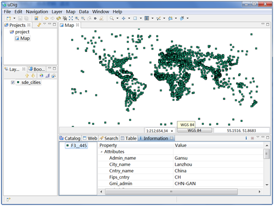
图 20 uDig中加载ArcGIS Server发布的WFS服务
